Our Canada · Lesson 2
Whose Land Are We On?
A promise from 1784.
Our school is inside it.
Waterloo Catholic District School Board
Our Land Acknowledgement
The schools in the Waterloo Catholic District School Board are situated on the Haldimand tract of land that is the traditional home of the Haudenosaunee, Anishinaabe and Chonnonton People. We acknowledge the enduring presence and deep traditional knowledge, laws and philosophies of the Indigenous Peoples with whom we share this land today.
We seek a new relationship with the Original People of this land, one based on honour and deep respect. We are grateful for the opportunity to learn here and reaffirm our collective commitment to make the promise and the challenge of Truth and Reconciliation real in our community.
Three nations, one land
Who does our acknowledgement name?
Haudenosaunee
“People of the Longhouse.” Six nations joined as one: Mohawk, Oneida, Onondaga, Cayuga, Seneca and Tuscarora.
Six Nations of the Grand River is their community on the river today.
Anishinaabe
Their own name means “the original people.” They include the Ojibwe and the Mississaugas.
The Mississaugas used parts of our region by season.
Chonnonton
Outsiders called them “Neutral” or “Attawandaron.” In the 1400s they lived in villages of 800 to 1,000 people right here.
Sources: University of Waterloo, Office of Indigenous Relations; Waterloo Public Library
Map Detective
How to play
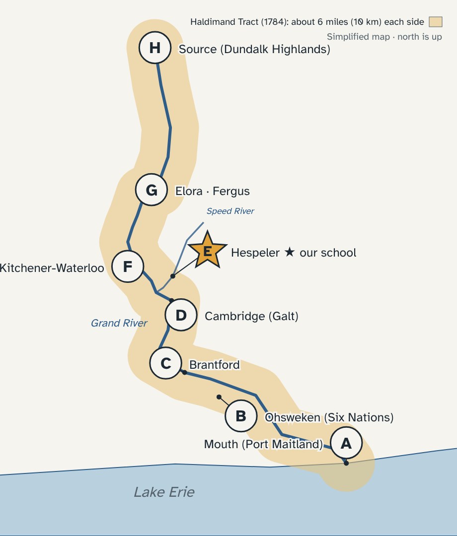
1 Read the clue together.
2 Your team has 30 seconds to write ONE letter, A to H.
3 “3-2-1, boards up!” Right letter = 10 points.
4 Say the place name too? +5 bonus.
Class challenge
All teams together: beat 500 points.
Where am I?
Round 1 of 8
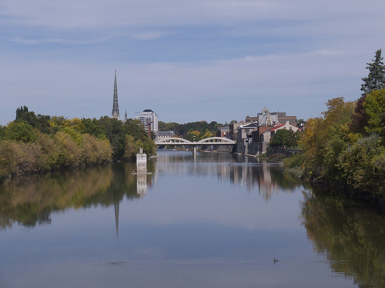
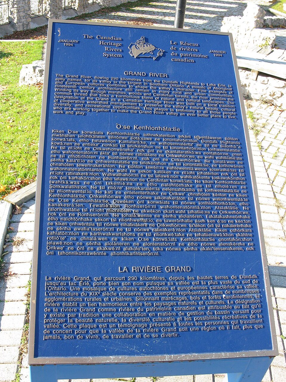
In 1994 the Grand became a Canadian Heritage River. A plaque here tells its story in three languages: English, French and one more.
30 seconds · write one letter, A to H
Cambridge (Galt)
Round 1 · Answer
D
The third language is Mohawk. The plaque was unveiled here on September 26, 1994. It names the river’s mix of Indigenous and European cultures.
Source: Grand River Conservation Authority · Photo: Saforrest · CC BY-SA 4.0
Where am I?
Round 2 of 8
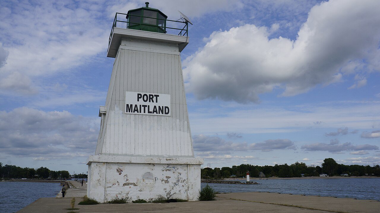
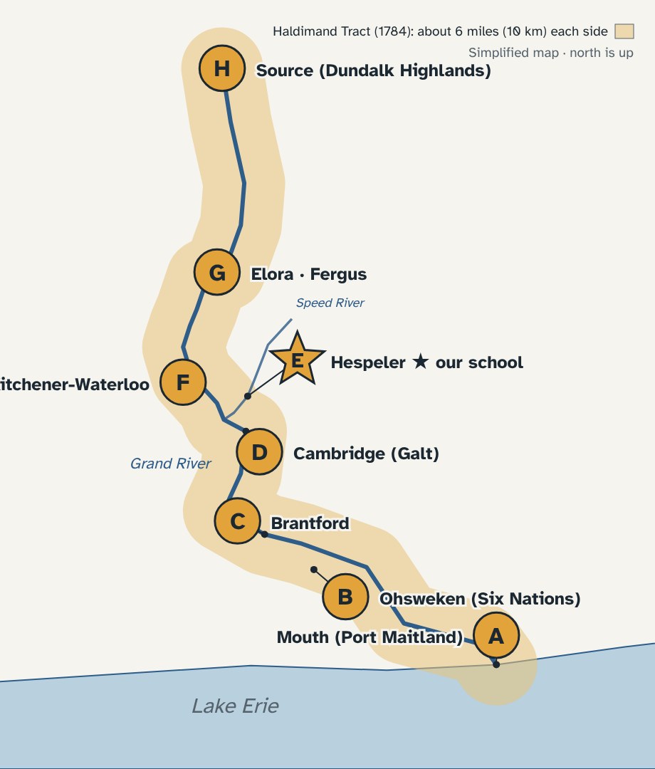
The river ends here and pours into a Great Lake. The 1784 promise starts right here, at the lake.
30 seconds · write one letter, A to H
The Mouth of the River
Round 2 · Answer
A
The promise gave the Six Nations land “six miles deep from each side of the river,” starting here at Lake Erie, “which them and their posterity are to enjoy for ever.”
Source: Haldimand Proclamation, 1784 · Photo: Port Maitland Lighthouse, JFVoll · CC BY-SA 4.0
Where am I?
Round 3 of 8
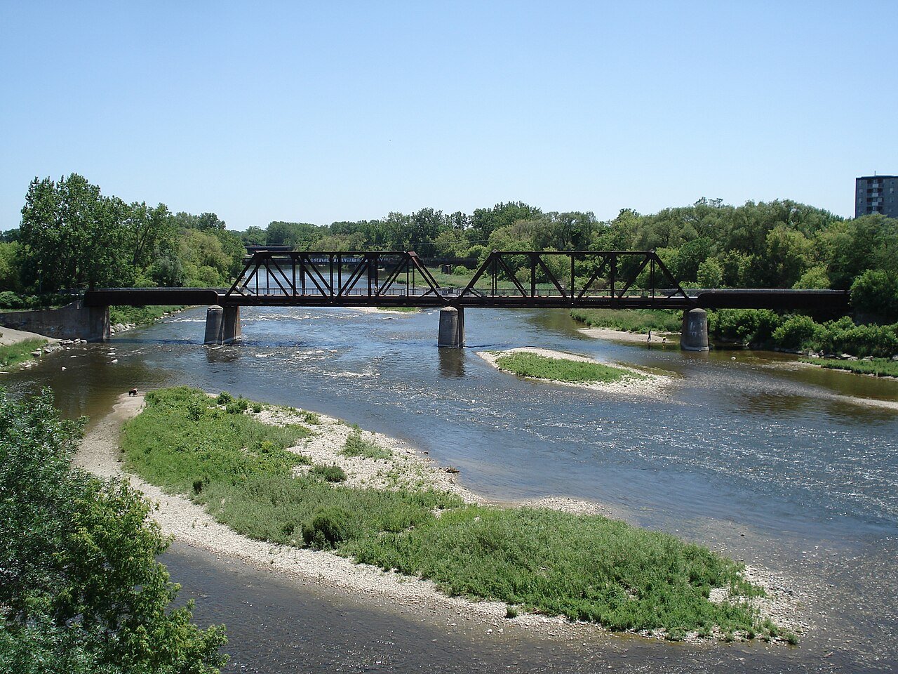
This city is named after a Mohawk leader who brought his people to the Grand River after the American Revolution.
30 seconds · write one letter, A to H
Brantford
Round 3 · Answer
C
“Brant’s Ford,” named for Joseph Brant (Thayendanegea). The Mohawk sided with Britain in the American Revolution and lost their homelands in New York.
Sources: Encyclopaedia Britannica; Parks Canada · Photo: Balcer · CC BY 2.5
Where am I?
Round 4 of 8
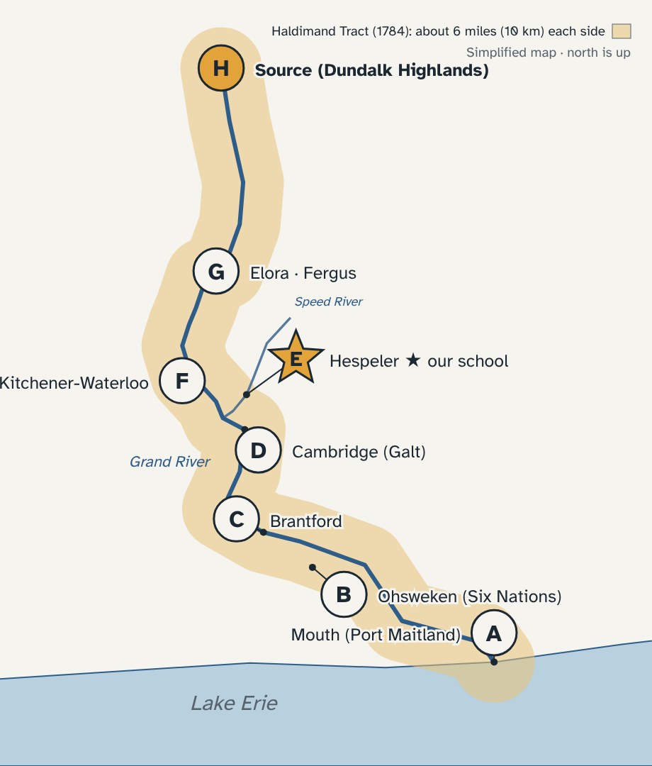
The river begins here, in the highlands, and flows 290 km to Lake Erie. The 1784 promise called this “the head of the said river.”
30 seconds · write one letter, A to H
The Source
Round 4 · Answer
H
The Grand starts in the Dundalk Highlands. It is the largest river in Southern Ontario, and the promise was meant to follow it all the way from Lake Erie to here.
Sources: Grand River Conservation Authority; Haldimand Proclamation, 1784 · Map: Our Canada
Where am I?
Round 5 of 8
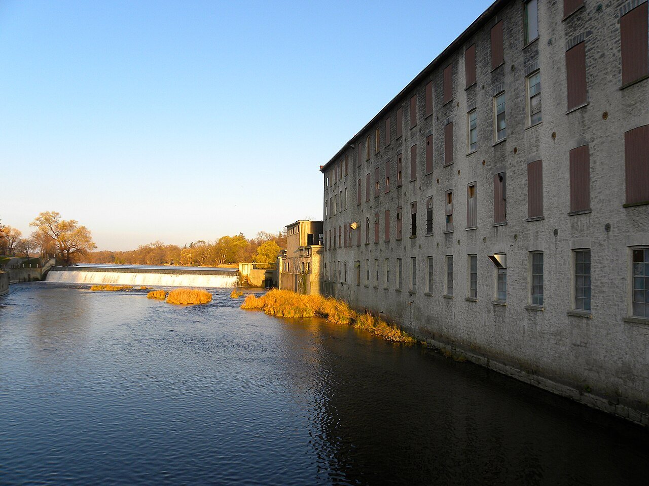
You are sitting here right now. This old mill village grew up on a smaller river that flows into the Grand.
30 seconds · write one letter, A to H
Hespeler: Our School
Round 5 · Answer
E
Hespeler was part of Waterloo Township. That township began as Block 2: part of the land promised to the Six Nations in 1784.
Sources: Region of Waterloo Museums; WCDSB · Photo: JasonParis · CC BY 2.0
Where am I?
Round 6 of 8
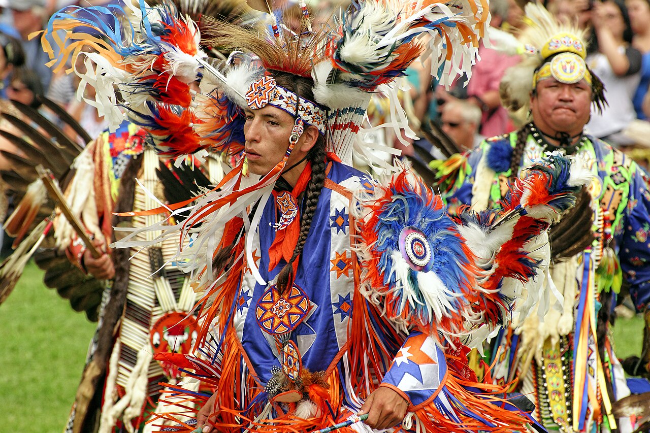
Only a small part of the promised land still belongs to the Six Nations today. Their main community is here.
30 seconds · write one letter, A to H
Ohsweken, Six Nations
Round 6 · Answer
B
About 950,000 acres were promised. Today about 48,000 acres remain Six Nations land: roughly 5 out of every 100.
Sources: Six Nations of the Grand River; University of Waterloo · Photo: Six Nations powwow, Peter K Burian · CC BY 4.0
Where am I?
Round 7 of 8
Two towns with a famous gorge sit in the northern part of the tract. North of them, a 1791 survey’s straight lines left land out.
30 seconds · write one letter, A to H
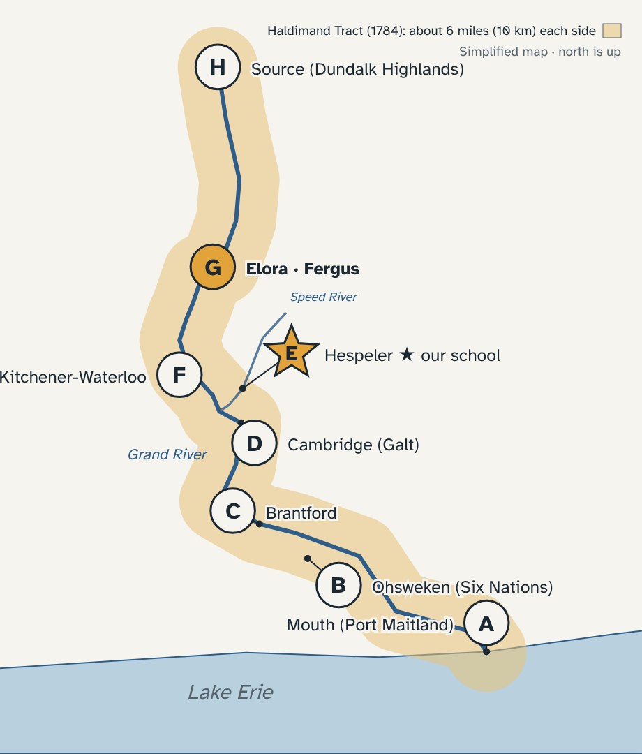
Elora and Fergus
Round 7 · Answer
G
The promise said the land reached the river’s source. A 1791 survey drew straight lines instead of following the river, and land at the north end was cut off. People still disagree about how big the tract was meant to be.
Source: Waterloo Public Library, “A Brief History of the Land in Waterloo Region” · Map: Our Canada
Where am I?
Round 8 of 8
In 1803, Mennonite families from Pennsylvania bought about 60,000 acres here. One settler’s sawmill grew into a city.
30 seconds · write one letter, A to H
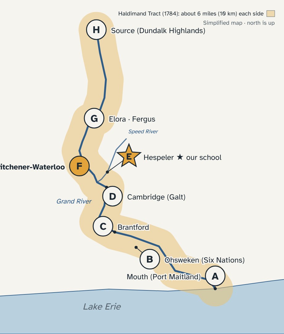
Kitchener-Waterloo
Round 8 · Answer
F
The families formed the German Company and bought most of Block 2. Abraham Erb built a sawmill on Laurel Creek in 1808, and the village of Waterloo grew around it.
Sources: Region of Waterloo Museums; Waterloo Public Library · Map: Our Canada
The shrinking tract
What happened to the promise?
950,000
acres promised, 1784
48,000
acres Six Nations land today
If the promise were 20 squares, only about 1 is left. Land was leased, sold, and surveyed away, piece by piece.
Sources: Six Nations of the Grand River; Waterloo Public Library
Notebook · Page 2
Title: Whose Land Are We On?
1
Sketch the Grand River. Put a star where our school is.
2
Name the three nations in our land acknowledgement.
3
What was promised in 1784? What happened to it?
DONE?
1 Level Up: write one sentence of your own acknowledgement
2 Help a teammate finish
3 Book work: which nation or town could be your chapter?
Point of view
Through their eyes
Naskumituwin
A young Cree hunter witnesses the making of a treaty.
Watch for: What did his people think the treaty meant?
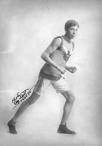
Tom Longboat
An Onondaga runner from Six Nations of the Grand River.
Watch for: What did he have to deal with that other runners did not?
Big idea
A promise looks different depending on who is telling it. How would the government tell these stories?
Videos: Heritage Minutes, Historica Canada (linked, not copied) · Images: W. Chewett map, 1821, public domain; Tom Longboat: Canada. Patent and Copyright Office, Library and Archives Canada / Acc. no. 1966-094 / e010857298
Image credits
| Image | Creator | Licence |
|---|---|---|
| Grand River map (A–H) | Our Canada, simplified | Original |
| Grand River, Cambridge | JustSomePics, via Wikimedia Commons | CC BY-SA 4.0 |
| Port Maitland Lighthouse | JFVoll, via Wikimedia Commons | CC BY-SA 4.0 |
| Six Nations powwow | Peter K Burian, via Wikimedia Commons | CC BY 4.0 |
| Tom Longboat | Canada. Patent and Copyright Office, Library and Archives Canada / Acc. no. 1966-094 / e010857298 | Public domain (copyright expired) |
| Grand River, Brantford | Balcer, via Wikimedia Commons | CC BY 2.5 |
| Heritage River plaque | Saforrest, via Wikimedia Commons | CC BY-SA 4.0 |
| Downtown Hespeler | JasonParis, via Wikimedia Commons | CC BY 2.0 |
| Mohawk Chapel | Ymblanter, via Wikimedia Commons | CC BY-SA 4.0 |
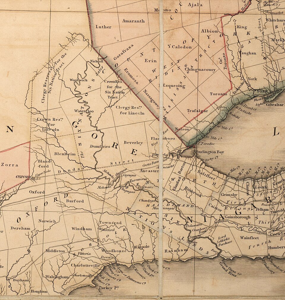
| Map of Upper Canada, 1821 | William Chewett | Public domain |
Split-grade classes only
Swap rounds
5/6 class
Round 2 → One Dish, One Spoon
Round 8 → The Chonnonton
6/7 class
Round 3 → The Mohawk Chapel
Round 8 → Beasley’s Mortgage
Where am I?
5/6 · Round 2 · Grade 5 lead
Around 1701, the Haudenosaunee and the Anishinaabe agreed to share the hunting lands of southern Ontario, like one dish with one spoon. Which letters does that agreement cover?
Trick round · you may write more than one letter
One Dish, One Spoon
5/6 · Round 2 · Answer
All of them
The whole region was shared hunting land: one dish, used by both nations. This agreement came more than 80 years before the 1784 promise.
Sources: Six Nations of the Grand River; University of Waterloo · Map: Our Canada
Where am I?
5/6 · Round 8 · Grade 5 lead
In the 1400s, Chonnonton villages of 800 to 1,000 people stood in this region, where two big side-by-side cities stand today.
30 seconds · write one letter, A to H
The Chonnonton
5/6 · Round 8 · Answer
F
About 40,000 people in the early 1600s. French visitors called them “Neutral” because they stayed out of their neighbours’ wars. Famine, disease and war cut their numbers, and survivors joined other nations.
Sources: Waterloo Public Library; University of Waterloo · Map: Our Canada
Where am I?
6/7 · Round 3 · Grade 7 lead
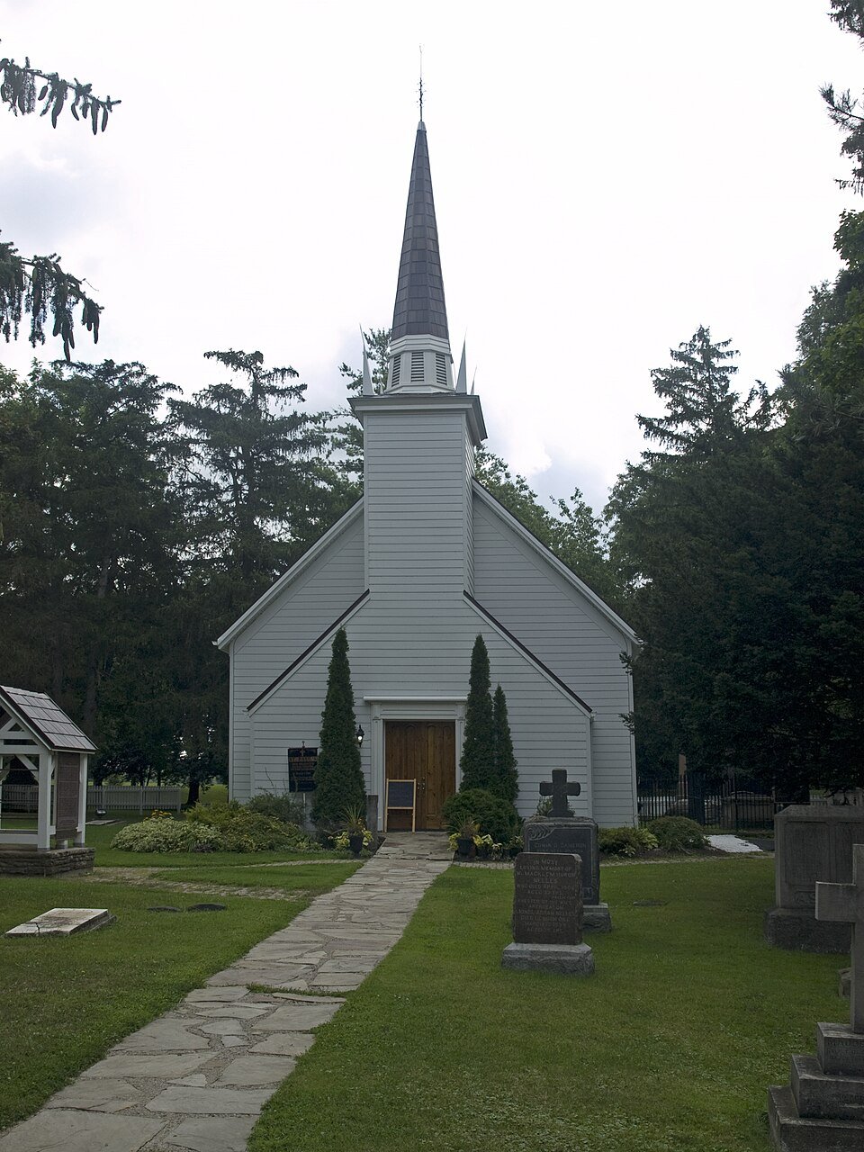
In 1785 the Crown built a small wooden chapel here as a gift to the Mohawk. It is the oldest surviving church in Ontario.
30 seconds · write one letter, A to H
The Mohawk Chapel
6/7 · Round 3 · Answer
C
Built for the Mohawk who lost their New York homelands as Britain’s allies. It was the first Protestant church in Upper Canada. Joseph Brant is buried in its churchyard.
Source: Parks Canada · Photo: Ymblanter · CC BY-SA 4.0
Where am I?
6/7 · Round 8 · Grade 7 lead
In 1796, a trader named Richard Beasley got this block from Joseph Brant. Then he sold farms to settlers before he had finished paying the Six Nations.
30 seconds · write one letter, A to H
Beasley’s Mortgage
6/7 · Round 8 · Answer
F
In 1802, Mennonite settlers found out they did not fully own their farms. They formed the German Company, bought about 60,000 acres, and the debt to the Six Nations was finally paid.
Sources: Region of Waterloo Museums; Waterloo Public Library · Map: W. Chewett, 1821, public domain
Split-grade notebook
Same page, your grade’s question
Grade 5
Who lived here before 1700? How is sharing land different from owning it?
Grade 6
What was promised in 1784? What happened to it?
Grade 7
Who gained and who lost when Block 2 was sold? Use one fact.